Medical District, Austin
Medical District covers 0.6 square miles of Austin, and about 1,175 people live here. This page maps 81 parks and public places and 11 businesses inside its lines, most of them Food and Drink.

Living In Medical District
Medical District has about 1,175 people on 0.6 square miles, 1,883 per square mile, more spread out than Austin as a whole (2,530).
The median household earns $98,706 a year, 5% above the city median, #61 of 143 neighborhoods.
55% of homes are rented, and the median rent is $1,648 a month.
It is an older part of town: 62% of homes were built before 1960.
People here skew older, with a median age of 44 against 35 citywide.
27% of workers walk to work, against 2% across Austin.
94% of homes have broadband internet.
Inside its lines: 50 landmarks and historic sites, 7 parks, 4 places of worship, 3 libraries and 5 places to eat.
People
Money And Work
Housing
Getting Around
Connected
US Census Bureau American Community Survey 2020 to 2024, added up from the census tracts in Medical District. Ranks count neighborhoods with 500 or more people.
Parks, Schools And Public Places In Medical District
Landmarks And Historic Sites 50
 Scholz Garten1607 San Jacinto Boulevard, Austin, 78701
 Texas Peace Officers Memorial
 Texas State Capitol112 East 11th Street, Austin, TX 78701
 Vietnam Veterans Monument
- Austin High School, Rio Grande Campus
- Brackenridge Hospital
- Carrington-Covert House
- Confederate Texas Legislatures
- Copy of Statue Of Liberty
- Daniel H. Caswell House
- Denny-Holliday House
- Diocese of Austin
38 more on the map below
Parks 7
- Austin Recreation Center1301 Shoal Creek Boulevard, Austin, TX 78701
- Capitol Mall
- Capitol Square
- Health Learning Building Courtyard
- Lady Bird Johnson Texas Capitol Flower Gardens
- Luci and Ian's Family Hill Country Garden
- Waterloo Park500 East 12th Street, Austin, TX 78701
Places Of Worship 4
- Christ Science Church
- Diocese of Austin Chancery1600 Congress Avenue, Austin, 78701
- First United Methodist Church of Austin1201 Lavaca Street, Austin, 78701
- St. Martin's Ev. Lutheran Church606 West 15th Street, Austin, 78701
Libraries 3
- Collections Deposit Library1810 Red River Street, Austin, TX 78701
- Lorenzo de Zavala State Archive and Library
- Texas State Law Library
Sports Fields 3
- Denton A. Cooley Pavillion1601 Red River Street, TX 78701
- Heath Eiland and Morgan Moss BMX Skate Park
- House Park
Civic Buildings 2
- Texas Supreme Court Building201 West 14th Street, Austin, TX 78701
- Travis County Civil and Family Courts Facility1700 Guadalupe Street, Austin, TX 78701
Museums 2
 Texas State History Museum1800 North Congress Avenue, Austin, TX 78701
- Capitol Complex Visitor Center
Post Offices 2
- PostNet1401 Lavaca Street, Austin, TX 78701
- United States Post Office111 East 17th Street, Austin, TX 78701-9997
Colleges 1
- Austin Community College Rio Grande Campus5930 Middle Fiskville Rd, Austin, TX 78752
Community Centers 1
- Austin Recreation Center1301 Shoal Creek Boulevard, Austin, TX 78701
Hospitals 1
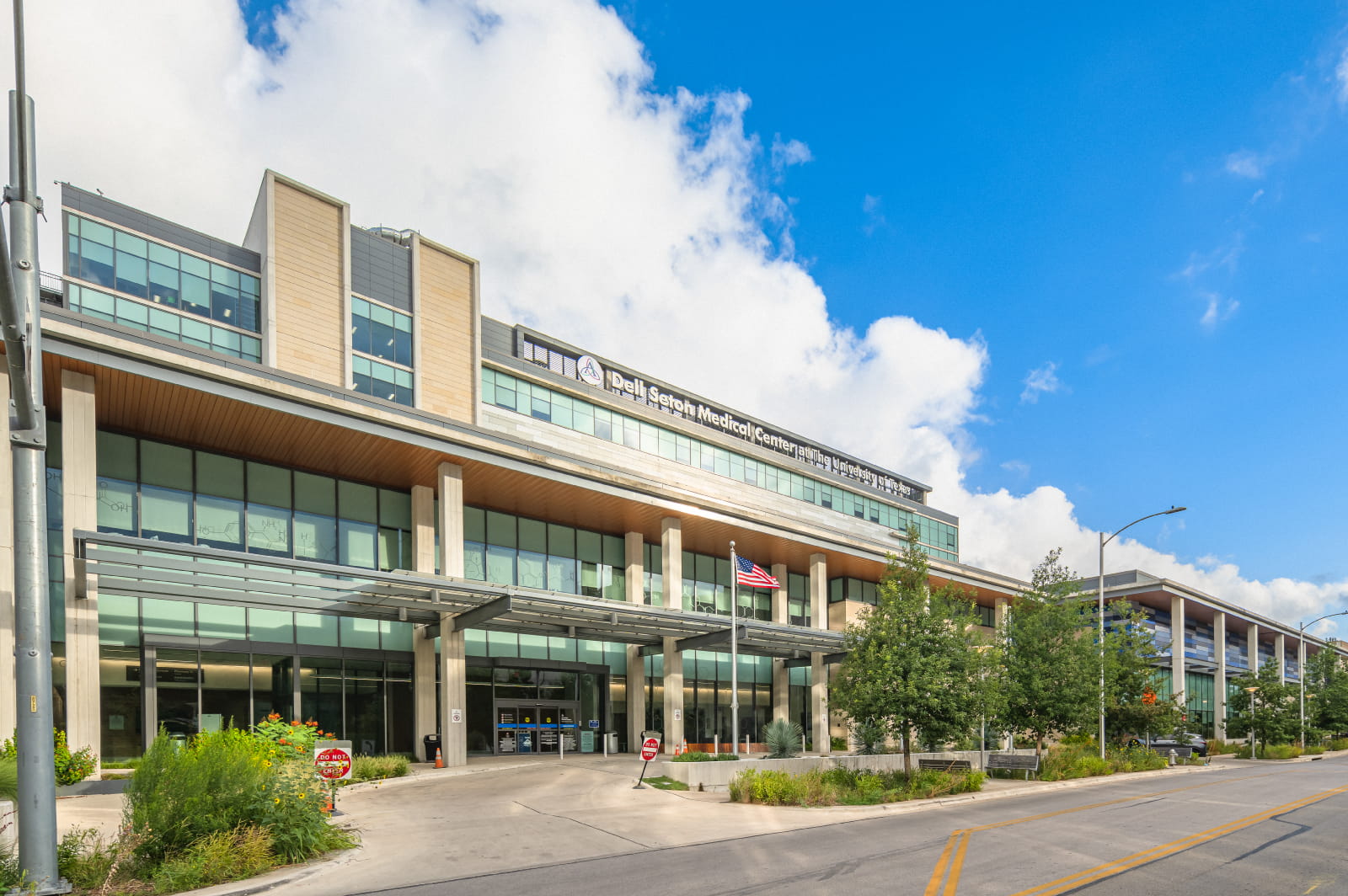
- Ascension Dell Seton Medical Center at The University of Texas1500 Red River Street, Austin, 78701
Playgrounds 1
- Kitty King Powell Lawn
Schools 1
- First United Methodist Church of Austin Preschool
Theaters 1
Trails And Bike Paths 1
- Shoal Creek Urban Trail
Transit Stops 1
- Megabus1500 San Jacinto Boulevard, 78701
Places To Go In Medical District
The most reviewed spots inside these lines, with photos where they have one.
Top Attractions And Things To Do
Parks, Beaches, Museums And Landmarks
Businesses In Medical District
Is yours missing or wrong? List or fix it free.
Food and Drink 5
 Clay Pit Contemporary Indian CuisineIndian restaurant
 Raising Cane's Chicken FingersFast food restaurant
 Scholz GartenGerman restaurant
 Chick-fil-AFast food restaurant
- Texas Chili ParlorTex-Mex restaurant
Lodging 2
Health and Medical 2
Entertainment and Arts 1
 Bullock Texas State History MuseumHistory museum
Government and Public Services 1
 Texas CapitolState government office
Own A Business In Austin
List it free on your neighborhood page in about two minutes. Townstoop is built by Clickflame, building local business sites since 2004.
Medical District Questions
How many people live in Medical District
About 1,175, from the Census American Community Survey tracts inside the Medical District lines.
What parks are in Medical District
7 mapped, including Austin Recreation Center, Capitol Mall, Capitol Square, Health Learning Building Courtyard.
How many schools are in Medical District
1 schools are mapped inside the neighborhood.
What is the rent like in Medical District
The Census median gross rent is $1,648 a month, against $1,729 for all of Austin.
Do people rent or own in Medical District
55% of homes are rented and 45% are owned, against 57% rented across Austin.
How do people get to work from Medical District
The average commute is 13 minutes. 40% drive alone, 1% take transit, 27% walk and 26% work from home.
How old are the homes in Medical District
62% were built before 1960 and 4% in 2010 or later. 14% are single family homes.
Is Medical District a family neighborhood
1% of households have children and 1% of residents are under 18. 20% are 65 or older.
Sources, Census figures from the US Census Bureau American Community Survey five year estimates, parks, schools and public places from OpenStreetMap contributors (ODbL). How we build these pages.